- 定價217.00元
-
8
折優惠:HK$173.6

|
|
|
|
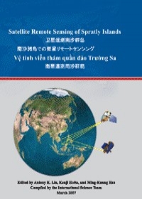
衛星遙測南沙群島
|

|

沒有庫存
訂購需時10-14天
|
|
|
|

|
|
9789861227269 | |
|

|
|
堀田健治 | |
|

|
|
鼎茂 | |
|

|
|
2007年4月13日
| |
|

|
|
267.00 元
| |
|

|
|
HK$ 240.3
|
|
|
|
|

| |
|
|
|
|
| |
|
|
詳
細
資
料
|
* 叢書系列:期刊(論文)
* 規格:精裝 / 普級 / 初版
* 出版地:台灣
期刊(論文)
|
|
分
類
|
[ 尚未分類 ] |
同
類
書
推
薦
|
|
|
內
容
簡
介
|
This book is compiled by the International Science Team (IST) members consisted of scientists from China, Japan, Philippines, Taiwan, U.S., and Vietnam. The formation of this IST was initiated at the special session on Spratly Islands during PACON 2003 in Kaohsiung, Taiwan. PACON (Pacific Congress of Marine Science and Technology) was formed in 1982 by Dr. Saxena and has many Chapters from most of Asian countries, so it is a powerful forum for discussion of international issues and collaboration. The strategic importance of the Spratly Islands lies in its marine geo-political location in the South China Sea. However, because of occupying and claiming by six different countries and regions, general information of Spratly Islands is extremely limited or not available under this difficult situation. Therefore, IST’s approach for the study of Spratly Islands is focused first on satellite remote sensing since it’s international intrinsically, so all members can participate in this research.
In early 2004, part of IST led by Professor Hotta (then PACON’s President) wrote a proposal and was later funded by the Office of Naval Research (coordinated by Antony Liu and managed by Tom Drake) for two years. The first workshop on Spratlys was held in Hawaii during PACON-2004 as the inception of IST. Then, the second Spratlys IST workshop was held in March 2005 at Nihon University in Chiba, Japan, and the third workshop in April 2006 at the National Center for Ocean Research in Taipei, Taiwan. There is also a special session on Spratly Islands at PACON 2005 in November at Chienkuo Technology University in Changhua, Taiwan. During all these Spratlys workshops there were many new observations, data/images, and findings presented on a variety of topics in the areas of satellite remote sensing. The promised success of these workshops is attributed to the outstanding efforts made by the members of IST, and this book is a collection of their presentations and lectures. A special gratitude is due to ONR, ONRG, PACON, NCOR, and Nihon University for their support. SAR data were collected at the Taiwan Ground Station, and all ERS-2 and ENVISAT data are copyrighted by ESA.
Finally, on behalf of my colleagues in the International Science Team, I sincerely welcome scientists and researchers from all over the world to provide your comments and suggestions for future collaboration. The views and assessments in this book are solely those of IST members and do not necessary reflect their sponsor Agencies or Governments.
|
|
|
書
評
|
|
|
|
|

